Staria

LOCATION
CLIMATES- NORTH-SKOGISH
- EAST-SKOGISH
- UPPER-SKOGISH
- SOUTH-SKOGISH
- WEST-SKOGISH
- CENTRAL-SKOGISH
Cultures
- HIGHLANDER
- JUNGLE
- SWAMP
- WALDER
Hordes
Egral Rulers
Noble Families & Organisations
Other Nobility
Guilds
Public Organisations
Shadowy Organisations
Thieving Organisations
Human Characters
Drakk Alfar Characters
Coinage of note:
Capital:
Cities of note:
Towns of note:
Inns of note:
Taverns of note:
Rest Spots of note:
Bridges of note:
Ruins of note:
Shrines of note:
Raw Materails of note:
Legend
“Like an avelance they rolled from mountains high, thundercracks and exploding rain from palms.”
History

Back in the First Age and early in Second Age there was Tribes of Findograa living in Starias Northern parts. But during the Ortagui Empire they where thinned severely. Especially as the Kinoblin aided the Ortagui so they could get their Junks filled with slaves.
The Tatongōl coming across the mountains from the South with their herds didn’t make things easier for the rural folks. When Tatongol and Ortagui mixed and became Ughuz, establishing towns and cities with a need for agricultural lands. It got worse, ending when the Ughuzzan Empire was announced and a crusade as rapid as the Explosive Powder, Cannon, and Handgun used to obliterate their settlements and towns.
Skjald Valgrif
The two Empires fought for several centuries and the Findograa perished in Staria, leaving but Ughuz, Ortagui, Tatongol and the slowly growing Common lot. Who manouvered cleverly in the Age of Hordes and grew steadily. So that they now form a major part of the population.
Skjald Vinotis
Cartography
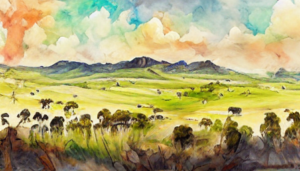
As its North of the mountains, the climate is warm all year around. Its a Country of vast grasslands and crop fields stretching as far as one can see. To the West Lumiis Sinking ends in Munitars Valley leading up to Johras Passage between Mt. Vaggy and Mt. Qeriz. North of Mt. Qeriz is the narrow Meelus Rift cutting deep between it and Omarls Peak.
In central North the Sukuda Roughs, Koboldii Heights, Kza'noobo Kiznoll, and Rhimo Wilds leads Eastwards to Kullme Ironknolls and a handfull of mountains.
Central areas are; Skymir’s Point, Özmarrs Ridge, Ongol Steppes, M’Bhaktu Kettle, Oelmen’s Sinking, Tatongii Plateau.
Skjald Sejrik
Organisation
Each Settlement; Hamlet, Village, Town and CityCountry are generally governed by one of the major population factors, Ughuz, Ortagui, or Common. The same goes for road- and bridgeposts and isolated stables or inns. But out on the steppes, rouglands or foothills its the Tatongol one most likely meet, and in the wilderness, forests or mountains – N-Erectus set the terms.
Skjald Ulrich
Special
Be aware of Slavers.
Skjald Sigurd
Last Updated on 2024-03-13 by IoM-Christian
